Sligo added to orange thunderstorm warning as heatwave continues
Michael Bolton
Sligo has been added to an orange thunderstorm warning, which lasts until 9pm.
Galway, Mayo and Roscommon are no longer under the alert from now.
The status yellow heat advisory for the entire country ends at 9am on Saturday.
Advice from Met Eireann warns of temperatures exceeding 27 degrees and a risk of heat stress.
Saturday will be cloudier with showery rain spreading eastward through the morning & turning heavy or thundery at times in the midlands & east during the afternoon & eveningð¦ï¸âï¸
Cooler than previous days with highs of 19 in the west to 23C in the east pic.twitter.com/okue1plzn4
— Met Éireann (@MetEireann) June 26, 2026
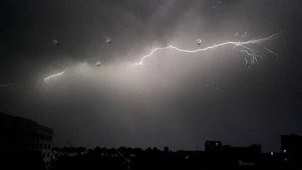
There will be clusters of thunderstorms in places, but not all areas will experience them, Met Éireann said.
Possible impacts include localised flooding, hail damage, difficult travelling conditions, damage to utilities including power, water, gas, telecommunications, very gusty winds and lightning damage.
Status Orange-Thunderstorm warning for Galway, Mayo,Roscommon
Possible impacts:
• Localised flooding
• Hail damage
• Difficult travelling conditions
• Damage to utilities
• Very gusty winds
• Lightning damageValid: 16:56 to 20:00 Friday 26/06/2026https://t.co/w5QtJ1UyEP pic.twitter.com/QptS1wJ6G7
— Met Éireann (@MetEireann) June 26, 2026
Three weather stations – Oak Park, Co Carlow, Moore Park, Co Cork, and Gurteen, Co Tipperary – met heatwave criteria after they recorded temperatures above 25 degrees for five consecutive days, including today, Met Éireann confirmed on Friday.
Three stations also, provisionally, had tropical nights last night. These were:
- Oak Park, Co Carlow (20.3 degrees)
- Casement Aerodrome, Co Dublin (20.4 degrees)
- Cork Airport, Co Cork (20 degrees)
Seven of Met Éireann’s automatic stations also had tropical nights ending 9am this morning, the forecaster said:
- Portlaoise WWTP, Co Laois (21 degrees)
- Curragh Racecourse, Co Kildare (20.8 degrees)
- Clonmel WWTP, Co Tipperary (20.7 degrees)
- Edenderry (Ballinla), Co Offaly (20.3 degrees)
- Durrow (Castlewood), Co Laois (20.2 degrees)
- Piltown (Kildalton Agri College), Co Kilkenny (20 degrees)
- Bunclody WWTP, Co Wexford (20 degrees)
15,000 homes and businesses were without power after intense thunder and lightning hit on Thursday night.
The Road Safety Authority has advised motorists to slow down and allow a greater braking distance between you and the vehicle in front, take alternative routes if roads are flooded, and drive with dipped headlights at all times.
The warning comes as Ireland had its hottest day of the year on Thursday.
A status yellow high temperature warning remains in place until 9am on Saturday.
The National Directorate for Fire & Emergency Management have met with key stakeholders due to the weather warnings across the country.
Met Éireann said it will be hot and humid across the country.
The highest temperature recorded in Ireland was 33.3C at Kilkenny Castle on June 26th, 1887.
The highest temperature recorded in Ireland on Thursday was 32.1 degrees in Athenry, Co Galway
Friday will continue to be warm and humid, with the risk of thundery showers.
Highest temperatures of 23 to 29 degrees, warmest across the midlands, east and northeast, but a few degrees cooler in the northwest and near the south coast.
Saturday will see outbreaks of rain in the west, which will gradually spread eastwards over the country on Saturday.
There will still be some drier and brighter interludes, these probably at their best in the east and northeast during the morning. Highest temperatures of 17 to 23 degrees, warmest in the east and northeast.
Sunday will bring a mix of sunny spells and scattered showers, he showers will be mainly in the west and north at first but they'll spread elsewhere in the afternoon and evening. Highest temperatures range from 15 degrees in the west to 20 degrees.


